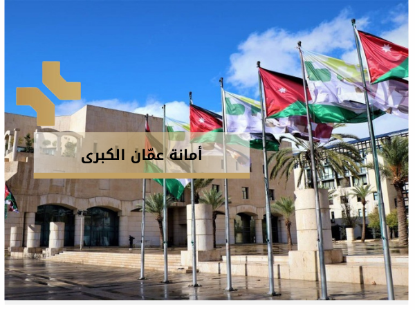
The Greater Amman Municipality is one of the state’s main institutions. It serves as the municipal authority of the capital city, Amman, and is responsible for its management, development, and service provision to citizens.
A civil institution with financial and administrative independence.
It creates, abolishes, and determines the boundaries of its area, functions, and powers.
The boundary area of Amman is 800 square kilometers.
The population of the capital, Amman, exceeds 4 million people.
The Amman Municipality Council is composed of members directly elected by the people, with one-third appointed by a decision of the Council of Ministers.
The financial resources of the municipality come from taxes and service fees, such as building licenses and traffic violations.
Amman Municipality provides 134 services to various segments of society, ministries, and public and private sectors.
The geographic space of the municipality is divided into 22 administrative regions.
The administrative tasks of the municipality cover 8 sectors: (Public Works, Planning, Health and Agriculture, Regions and Environment, Finance and Administration, Community Development).
The year 1909 witnessed the establishment of the first municipal council in Amman to manage and organize the affairs of the residents who settled in Amman at that time. The population was spread across 300 families, totaling 2,000 individuals.
The year 1950 marked the transformation of the Amman Municipality from a municipality into a greater municipality, in response to the population influx following the 1948 war.
In this year, the Greater Amman Municipality was officially established due to the increasing population and the trend toward expanding Amman’s spatial area. A comprehensive master plan for Amman and its surroundings was launched.
A pioneering institution to make Amman resilient, modern, and sustainable, while proud of its heritage.
To provide excellent, smart, sustainable, and flexible municipal services while preserving the identity of Amman.
Empowerment
Governance
Participation
Innovation
Excellence
Positivity
Belonging
Social Responsibility
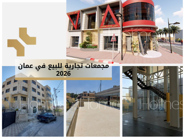
In this context specifically, the Greater Amman Municipality has played an important role in facilitating property selection based on real estate regulations and systems. It classified residential lands into various categories according to use, such as Residential (A), (B), (C), and (D), with each classification having its own rules (e.g., permitted building area, number of floors, plot area, etc.).
Other categories include commercial, industrial, and agricultural designations.
Today, Homes Jordan follows a clear strategy when selecting properties to advertise on its website Homes-Jordan, considering factors such as administrative zoning, location, specifications, legal status, and other strategic aspects.
After exploring the role of zoning regulations in classifying properties, it's important to understand how these classifications help people identify property types by simply knowing the residential category.
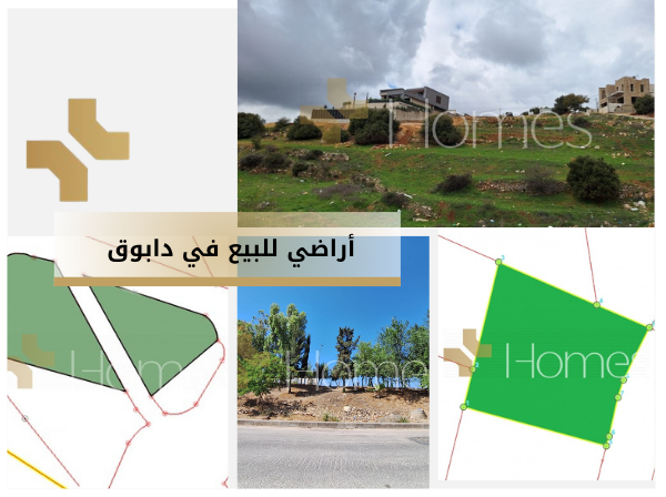
For example, if you hear “Dabouq,” it is understood as a zone with specific zoning rules, mainly for private, standalone villas, with a limit of two floors plus a roof. It’s considered among the most luxurious areas in Amman. Likewise, Abdoun, Deir Ghbar, and Khalda are also upscale areas, typically zoned as private housing, Residential (A), or sometimes Residential (B).
In contrast, areas in East Amman like Tabrbour and Jabal Al-Hussein are mostly categorized starting from Residential (B).
Thus, someone searching for a rental or property for sale can predict the housing type, neighborhood nature, and pricing accordingly.
This is an electronic GIS system developed by the Amman Municipality. It offers both free and paid services under the Geographic Information Systems Department.
Amman Explorer
Tourist Routes
Rapid Bus System
Cemeteries
Public Transport
Map request
Analytical studies
Digital data – student
Digital data – other
GIS applications – electronic services
A unit within the Amman Municipality, activated as a digital platform in 2008, designed to enable planners, researchers, and developers in various development sectors to:
Make informed decisions
Direct development plans
Monitor and evaluate progress toward local and global goals
This is done by collecting, analyzing, and producing urban indicators to present a comprehensive representation of Amman.
The Amman GIS Explorer provides comprehensive, constantly updated information about the city under the concept of a “smart city.”
It uses digital maps to organize and present geographic data.
It allows users to search for a variety of information, including:
Locations: e.g., lands, historical sites, tourist landmarks
Municipal Information: e.g., services, laws, and regulations
Routes: public transport, tourist paths, etc.
Planning and Economic Development Sector
Planning Directorate
Licensing Directorate
GIS Department
Urban Observatory Department
Planning and Budget Unit
Public Works Sector
Roads Directorate
Facilities and Buildings Directorate
Public Transport Directorate
Traffic Directorate
Fleet Directorate
Engineering Directorate
Construction Labs Unit
Regions and Environment Sector
Regions Directorate
Waste Management Directorate
Environmental Projects Directorate
Health and Agriculture Sector
Health and Professional Oversight Directorate
Agriculture and Forestry Directorate
Public Markets Directorate
Community Development Sector
Social Affairs Directorate
Sports Affairs Directorate
Cultural Affairs Directorate
Financial and Administrative Affairs Sector
Financial Affairs Directorate
Investment and Supply Chain Directorate
Real Estate Appraisal Directorate
Administrative Services Directorate
Human Resources Directorate
Institutional Performance Development Directorate
Institutional Excellence Department
Strategic Planning Department
Communication and Media Directorate
Amman Identity Department
Public Relations Department
Media Department
IT Directorate
Legal Affairs Directorate
Internal Audit and Control Unit
Each sector within the municipality has defined responsibilities that serve both the capital and its residents. Below is a breakdown of the core tasks by sector:
Urban planning to align with city growth and development
Oversight of construction and professional licensing
Managing databases and geographic applications
Providing decision-makers with citywide indicators
Designing, opening, paving, and maintaining roads, tunnels, bridges, sidewalks, and rainwater drainage systems
Planning and managing traffic and road safety
Managing and regulating public transportation
Designing and maintaining municipality facilities and projects
Crisis management coordination
Waste management
Overseeing construction and preventing violations or misuse
Creating and maintaining parks and green spaces
Preventing the spread of diseases and epidemics
Enhancing community well-being through cultural, sports, and social programs
Establishing and maintaining facilities and initiatives
Providing administrative and logistical services
Managing the municipality’s budget
Managing assets and inventories
Managing and developing human capital
Updating policies and strategic plans
Simplifying and improving services
Developing and maintaining e-services and tech support
Drafting laws, contracts, and representing the municipality in court
Managing public relations and branding the city’s identity
The Greater Amman Municipality is divided into multiple regions, each containing various neighborhoods. These are the main areas of Amman covered:
Al-Madina
Al-Abdali
Sweileh
Basman
Tareq
Muqabalin and Um Qusayr
Marka
Jubaiha
Tlaa Al-Ali, Khalda, and Um Al-Summaq
Al-Nasr
Shafa Badran
Badr
New Badr
Ras Al-Ain
Al-Qweismeh, Abu Alanda, Al-Rujeib, Al-Jwaidah
Abu Nseir
Al-Yarmouk
Khreibet Al-Souq
Uhud
Zahran
Wadi Al-Seer
Marj Al-Hamam
Can I check violations electronically?
Yes, through the official website of the municipality.
Is land and building tax collected by the municipality?
Yes, but only for properties within Amman and the capital governorate municipalities.
Where can I request a land map or title deed?
The Department of Lands and Survey is responsible for these, not the municipality.
Can I get a copy of an occupancy permit?
Yes, with a recent title deed and proof of ownership.
Can I file an objection online?
Yes, objections can be submitted via the official website — such as for property or land valuation.
What are the parceling services available?
Parceling outside zoning, road parceling, land parceling, and apartment parceling.
Can I get a construction license?
Yes, via the website — for existing or proposed buildings, inside or outside zoning limits.
How do I pay property tax?
Via the website or through municipal appraisal centers.
For questions about any service, call Homes Jordan: +962791230777
You can also reach out for legal or engineering consultations, and follow Homes Jordan on:
All article rights reserved to Homes Jordan – 2025

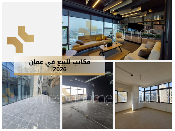
Real Estate Marketing in 2026
01-Apr-2026
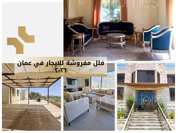
Luxury furnished villas for rent in Amman 2026
23-Mar-2026
Real Estate Lands for Sale in Dabouq, Amman 2026
09-Mar-2026
 JOD
JOD AED
AED USD
USD